Cycling
Cycling is a great way to keep fit, reduce your impact on the environment and is often a faster, cheaper way to travel when compared to other modes of transport. It is important that cyclists follow road and safety rules so that everyone can enjoy using shared networks.
Our Green City Plan has a target to increase cycling in our local government area by 10% by 2028, from a 2017 baseline. It’s an ambitious but important target to improve traffic and parking and to reduce our environmental impact.
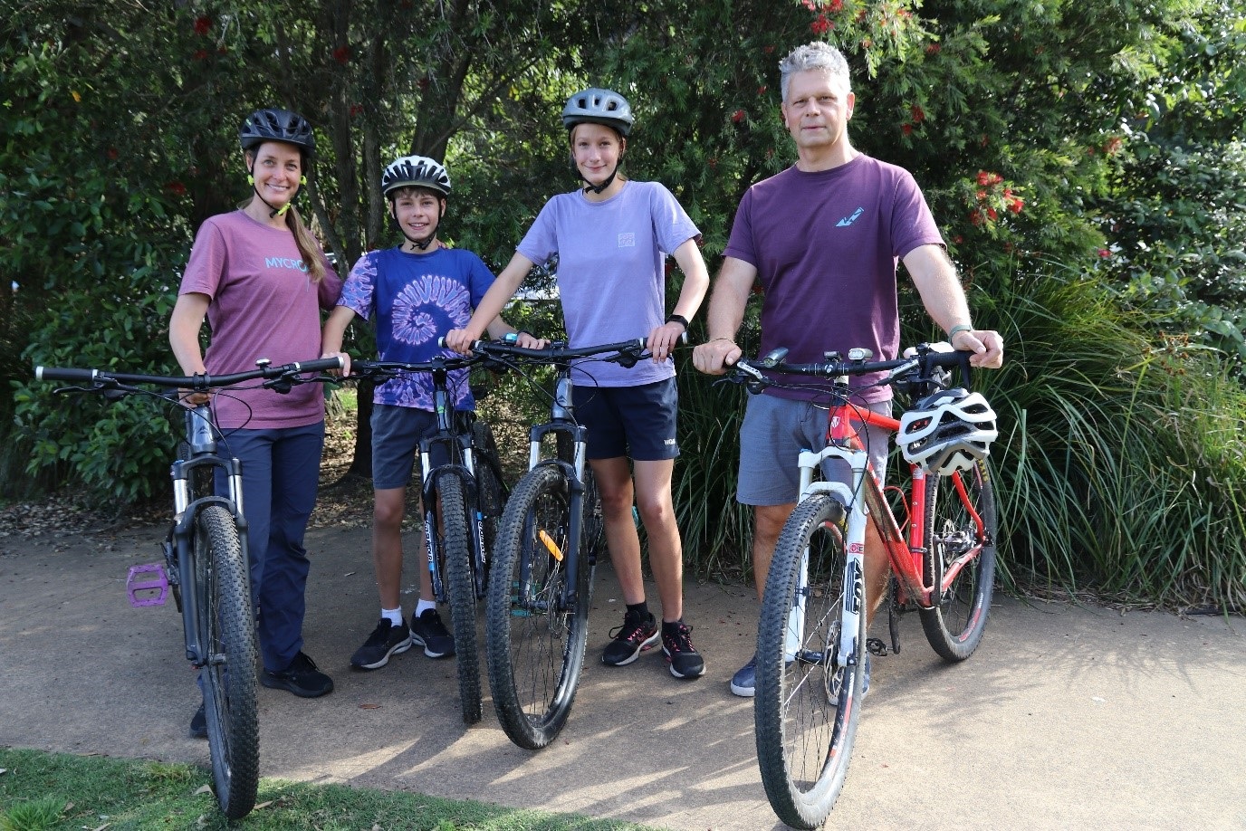
Image: Northbridge family of four: Nicole, Ben, Nina and Rom Bouveret.
The Bouveret family regularly cycle along Artarmon Reserve, Lane Cove, and Naremburn.
'I encourage parents to get out and follow their kids for a bike ride,' Mrs Bouveret said. 'I’ve found so many new bike routes by following Ben and Nina.'
Upcoming Events
Keep bikes rolling: Repair, recycle and buy

14
Jun
2026
Book a free bike tune-up, recycle old bikes or buy a refurbished one at this free event.
Artarmon Reserve, 2 Burra Road, Artarmon 2064
Tagged as: , Charity & Causes, Children, Education, Environment & Sustainability, Markets & Fairs, Older Adults, Sport & Recreation, Talks & Workshops, Youth
Riding within Willoughby
Cycling routes in the Willoughby local government area consists of a mix of dedicated bike paths, shared paths and marked on-road links which are shown on the Northern Sydney Cycling Guide and Map(PDF, 7MB).
Pacific Highway Shared Path
This new route provides connections to Chatswood CBD, Artarmon local centre, Artarmon industrial area, St Leonards, and regional destinations such as Naremburn, Lane Cove, North Sydney, Macquarie Park via connecting routes.
See map for routes:
New Chatswood to St Leonards Shared Path Route(PDF, 5MB)
How to get around
The following is also available:
Trip Planner allows you to enter your location and destination and then choose the bicycle icon to show routes based on difficulty. You can also choose a mixed trip using public transport and cycling via the refine tab.
Bicycle NSW provides a map that shows routes across greater Sydney.
Google Maps can help with routes and time to destination if you select bicycle as your transport mode. It also has a cycling layer that shows types of bike routes - go to map details and select ‘cycling’.
Sydney Bike Commuters is a Facebook group where you can share advice and ask questions about plotting routes.
Willoughby City Council 2017 Bike Plan
Willoughby City Council 2017 Bike Plan(PDF, 12MB)
Bike sharing
Bike share programs typically involve hiring a bicycle for a fee from an operator, which is either collected from a docking station or from the street (dockless bikes). Bike share operators and users must adhere to NSW road rules for cyclists and Council’s bikeshare guidelines(PDF, 218KB).
Bike share programs are entirely managed by commercial operators, not Council. Contact the bike share companies directly with any enquiries.
Currently, there are no bike share service providers operating within the Willoughby Council area. The Council remains concerned about e-bike riders using footpaths and the illegal parking of e-bikes on footpaths, as these issues impede safe access for pedestrians and other vulnerable road users.
Bicycle parking
Council provides bicycle racks at key locations throughout the area. An end-of trip facility is located in Council’s public car park under the Meriton Suites at 75 – 79 Albert Avenue, Chatswood. Secure bicycle lockers are available for hire at Chatswood, St Leonards, and Artarmon train stations, or through Transport Info.
All bicycles must be securely parked within designated bicycle parking areas or bicycle loops. They must be positioned in a manner that does not obstruct safe access for other road users or vulnerable pedestrians.
Cycling events
Love riding? Encourage others and participate in one of the national events this year.
National Ride2School Day on Friday 20 March 2026 is a great way to get your school involved and for your kids to discover the joy and health benefits of riding to school. Check out the resources provided by the Bicycle Network and encourage your school to register.
National Ride2Work Day on Wednesday 14 October 2026 provides a day to celebrate those that ride to work and to encourage new people to jump on a bike and have a go at cycling to work. Map out the safest and best way for you to ride via the NSW Government Trip Planner. Have more fun by getting your workplace involved and register to take part.
Biketober is a cycling challenge that takes place the whole month of October. You can sign up as an individual or a workplace and log your rides to win prizes and reach your cycling goals. Cycling tips and resources are on the Love to Ride website with registrations opening in August - September.
Bicycle commuting groups
Bicycle commuting groups are a great way for those interested in commuting by bike to get started. Riding with a commuting group allows people to build confidence by learning local bicycle routes, time to gain confidence on the road as well as the opportunity to become part of a cycling community.
Contact Bike North to connect with local cyclists and find out more on cycling events and activities.
Sydney Easy Riders is a bicycle commuting group based on Sydney’s North Shore that cycles through Willoughby to the city every work day.
E-bikes
E-bikes are increasingly popular as a way of getting around. The benefits of an e-bike are:
- You can ride longer distances and up hills more quickly and easily than on a push bike.
- You can choose the physical effort you expend by setting the assistance level - which means you can either get a workout or turn up to work without breaking a sweat.
- You can carry more - shopping or transporting a child on an e-bike is easier because the assistance can help you move the extra weight.
- You can travel door to door and avoid traffic jams.
- You can save money on car travel (petrol, parking and maintenance) and on public transport tickets.
- No air pollution is created as a result of your travel.
Considerations:
- Type of e-bike - power-assisted pedal cycles (throttle activated motor that can only work when you are pedalling) or electrically power-assisted cycles (pedal assisted so the assistance stops when you stop pedalling). Understand the NSW government rules on what is allowed.
- Styles of e-bike - road bike, folding bike, cargo bike, mountain bike.
- Weight of bike - most are over 18kg.
- Range of bike - there are 30-100km options.
- The life of the battery – how many charges are available.
- The assistance speed and the power output- note, there are legal upper limits depending on the type of bike.
- E-bikes use lithium-ion batteries to operate, it is important for you to understand the risks and be prepared if things go wrong. Visit the Fire + Rescue website to find out how to prevent fire risks and download their factsheets for more information.
- If you are 16 years + and not supervising a child under 16 years riding a bike, you cannot ride on a footpath. Understand the NSW road rules for bicycle riders.
Listen to our e-bike podcast where Alison Pryor and Carolyn New from Bike North chat about their passion for e-bikes. Learn how much they cost, how you charge them and how they can get you further faster!
More information (links):
More information (documents):