Blue Gum Reserve
Area: 14.4 ha
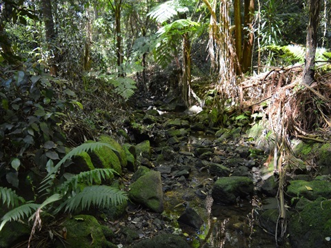
Blue Gum Reserve is bushland reserve located west of the Pacific Highway and north of Fullers Road in Chatswood.
Early industries that occurred in the area included timber-getting, orchards, market gardens and small dairies. There are also remains of the former Chatswood Rifle Range, such as a target wall built on an embankment and firing mounds with masonry walls. The Rifle Range remained operational until the Chatswood West Ward Progress Association, in co-operation with bordering progress associations, successfully moved it to Hornsby in June 1955.
Blue Gum Reserve is important as a contiguous link with Fullers Park, bushland managed by Kuring-gai Council, and the Lane Cove National Park, managed by the NSW National Parks & Wildlife Service to the west. This linkage provides a significant ecological corridor, particularly for highly mobile wildlife, such as birds and bats. Diversity of vegetation communities and geological niches provide habitat for a variety of wildlife including insects, lizards, frogs, Microbats, Grey-headed Flying Fox, Sugar Glider, Brown Antechinus, Long-nosed Bandicoot and many species of birds. It is home to both migratory and local birds, including the Powerful Owl which has a conservation status of vulnerable in New South Wales.
Location
Greville St, Chatswood 2067 View Map
-33.7980213,151.1684442
Greville St ,
Chatswood 2067
Greville St ,
Chatswood 2067
Blue Gum Reserve
Photo Gallery