H.D. Robb Reserve
Area: 20.5 ha
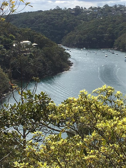
H.D. Robb Reserve is a linear reserve named after the former engineer and Willoughby Council town planner, Hugh Douglas Robb. Its setting in the upper reaches of Middle Harbour makes H.D. Robb a visually attractive reserve with spectacular panoramic views of Middle Harbour.
The reserve runs east west and is located in the suburb of Castle Cove. It is bordered on the west by Ku-ring-gai Council and Explosives Reserve to the east.
Before European occupation, H.D. Robb Reserve was home to the Cammeraygal clan of the Aboriginal people. The steep topography combined with the sandstone geology protects numerous Aboriginal archaeological sites, making it a reserve with high cultural significance.
The Reserve was part of Headland Heights Estate, developed by Headland Developments in the late 1950s. In 1958 the Hooker Corporation bought a controlling interest in the Greater Sydney Development Association, which owned the Castle Cove area. The reserve land was formally transferred to Willoughby Council on 1 January 1962.
There is a range of hollow bearing and stag trees, rock outcrops and bush rock structures on a largely inaccessible slope that provides suitable habitat for a range of animal species. Critical habitat, characterised by wet drainage lines below sandstone ridges, is recognised as a potential site for the threatened Red-crowned Toadlet. The lack of bush tracks also contributes to wildlife habitat values in this contiguous bushland reserve.
Location
Willowie Rd, Castle Cove 2069 View Map
-33.786085, 151.218245
Willowie Rd ,
Castle Cove 2069
Willowie Rd ,
Castle Cove 2069
H.D. Robb Reserve
Photo Gallery